The Toro-Semliki Wildlife Reserve
The TSWR lies near the western border of Uganda, within sight of the Congo. Its borders stretch from 0o 50' to 1o 05' North and 30o 20' to 30o 35'East. The nearest urban center is Fort Portal, 32 km south of the reserve, but only 10 km as the crow flies. The reserve takes up most of the western Great Rift Valley floor between the Rwenzori Mountains and Lake Albert, two of the several geographically, geologically and ecologically unique features that surround the reserve. The Western Rift Valley as a whole has been called one of “the most complicated features in Africa” (Verner and Jenik, 1984).
Looking west from the center of the reserve, the towering western rift escarpment in the Congo, across the Semliki River, is visible on clear days. The steep eastern slopes of the escarpment are part of the reserve and make up much of the range of the chimpanzees; the peaks of the escarpment have an elevation of up to 1900 m (Fig. 1). Most of the reserve is the gently undulating rift floor between the two escarpment at an elevation between 620 and 900 m (Verner and Jenik, 1984).
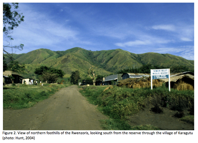
To the southwest of the reserve are the Rwenzori Mountains, the third highest elevation in Africa (after Kilimanjaro and Kenya), rising to over 5000 m and dominating the topography and influencing the climate in the region. The dramatic topography flanking the road to the reserve, with the Rwenzoris on the left and the eastern escarpment to the right, is the background image for this webpage. Incredibly, much of the uplift that created the Rwenzoris has occurred in the last 3 million years (McPhee, 2006). The peaks of the range stretch south for a hundred kilometers, spanning the equator and defining the boundary between the rainforests of the Congo and the more open, drier grassland-dominated biomes of East Africa.
Despite their prominence, the Rwenzoris were unknown to science until nearly the 20th century. Henry Stanley published the first description of the Rwenzoris in 1875. He described the dramatic topography with its ice-topped peaks to an astonished European audience. His 1875 publication was based on local accounts; it was another decade before he became the first European to see the glaciers that cover the peaks and higher slopes of the mountain range with his own eyes (Johnson, 1902). These glaciers, so recently known to the world, are shrinking, and may not survive to the 150th anniversary of Stanley's description of them. The glacier shrank a 75% from 1906 to 1990, from 6.5 sq. km. in 1906 to only 1.7 km2 in 1990 (Mölg et al., 2003), and they have continued shrinking since.
Although Stanley was the first non-African to view the Rwenzoris, they were long sought by European explorers racing to document the mountainous source of the Nile, a source described by the Ptolemy as early as 100 AD and given the romantic name 'the Mountains of the Moon.' The Semliki and Wasa Rivers drain from the Rwenzoris running north to empty into Lake Albert, which in turn feeds the Albert Nile via the spectacular Murchison Falls. in Murchison Falls National Park. MFNP also contains a well-studied population of chimpanzees in the Budongo forest. The River Wasa runs north to Lake Albert, almost precisely down the middle of the Toro-Semliki (Fig. 1). Most of the reserve on either side of the Wasa is open grassland, but close to the river is a robust riverine forest that supports diverse wildlife.
The northern boundary of the reserve is Lake Albert, the northernmost of the great rift lakes. As one of the few habitats where the majestic shoebill stork can be found—a common species on many birder life-lists—Lake Albert is a popular birder destination.
To the west of the reserve is the vast Congolese rainforest containing one of the richest, most diverse species reservoirs on the planet and one of the world’s largest stretches of unlogged forest. The forest extending west from the banks of the Semliki River across the entire continent to the Atlantic Ocean.
To the east of the reserve beyond the peaks of the escarpment are forests interspersed with savanna, transitioning to even drier biomes in far eastern Uganda to become the desert habitat known so well to the outside world from the popular images of the Maasai.
The location of the reserve at the junction of so many diverse habitats—tropical rainforest, marshy lacustrine habitats on the shores of Lake Albert, the escarpment ecotone to the east, the montane habitats of the Rwenzoris in the south, and including the grassland at the the heart of the reserve—makes for an abundant and diverse bird population, exceeding 400 species, but still not yet fully documented.
